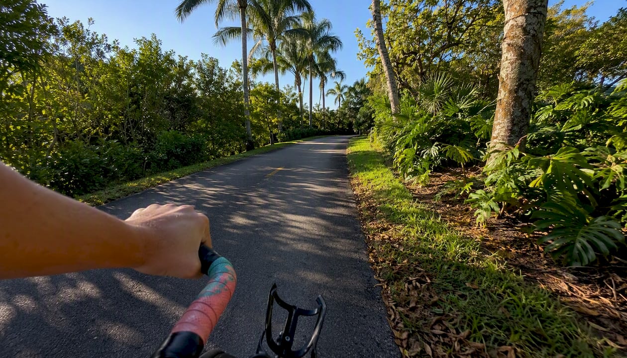
Boca Raton gives you three genuinely useful categories of bike routes right now: short, shaded family loops on paved multi-use trails (the El Rio Trail is the best starting point), longer paved greenway corridors for training rides, and connected commuter routes that link directly to Tri-Rail and Palm Tran stops. Your first move before any of these rides is to download the City of Boca Raton’s official “Biking in the City” bike map, which consolidates lane types, multi-use paths, and current project notices in one printable brochure. You can also pick up a paper copy at City Hall or a local community center.
- Family loops: El Rio Trail (paved, ~4.8 miles, shaded sections, connects to T-Rex Trail)
- Training/longer rides: paved greenway corridors and collector-road bike lanes across the city’s network
- Commuter connectors: routes that start or end at Yamato Road Tri-Rail station for multimodal trips
The city reports over 84 miles of bike lanes, shared pathways, and trails across Boca Raton, which means there is enough variety here to ride a different route every weekend for months.
Key Takeaways
Boca Raton’s 84-plus miles of bike infrastructure give every type of rider a practical route, but the official city map and a GPX export from Bikemap or TrailLink are what turn that network into a ride you can actually plan and execute.
| Point | Details |
|---|---|
| Start with the official city map | Download the “Biking in the City” brochure from myboca.us before planning any route. |
| El Rio Trail is the best default | 4.8 paved miles with T-Rex Trail connection; free parking at Yamato Road Tri-Rail station. |
| Red downtown lanes are for buses | Terracotta lanes in downtown Boca Raton are transit lanes, not bike lanes; use the adjacent road lane. |
| Use transit to extend your range | Tri-Rail bike lockers and Palm Tran’s Bikes on Buses program support multimodal rides across the city. |
| Cynthiagardens suits bike-first residents | Secure bike storage, pet-friendly policies, and Tri-Rail proximity make it a practical base for Boca Raton riders. |
Table of Contents
- Where can you get printable maps and GPX files for Boca Raton rides?
- The best bike routes in Boca Raton: 6 rides with distances and access points
- What you need to know about Boca Raton’s bike network, transit connections, and safety rules
- How to time your ride, find parking, and pack for Boca Raton’s conditions
- How Boca Raton’s bike policy shapes the routes you ride today and tomorrow
- What these routes actually mean for different kinds of riders
- Living near Boca Raton’s best trails? Cynthiagardens has you covered
- Primary sources and further reading
- Sources
Where can you get printable maps and GPX files for Boca Raton rides?
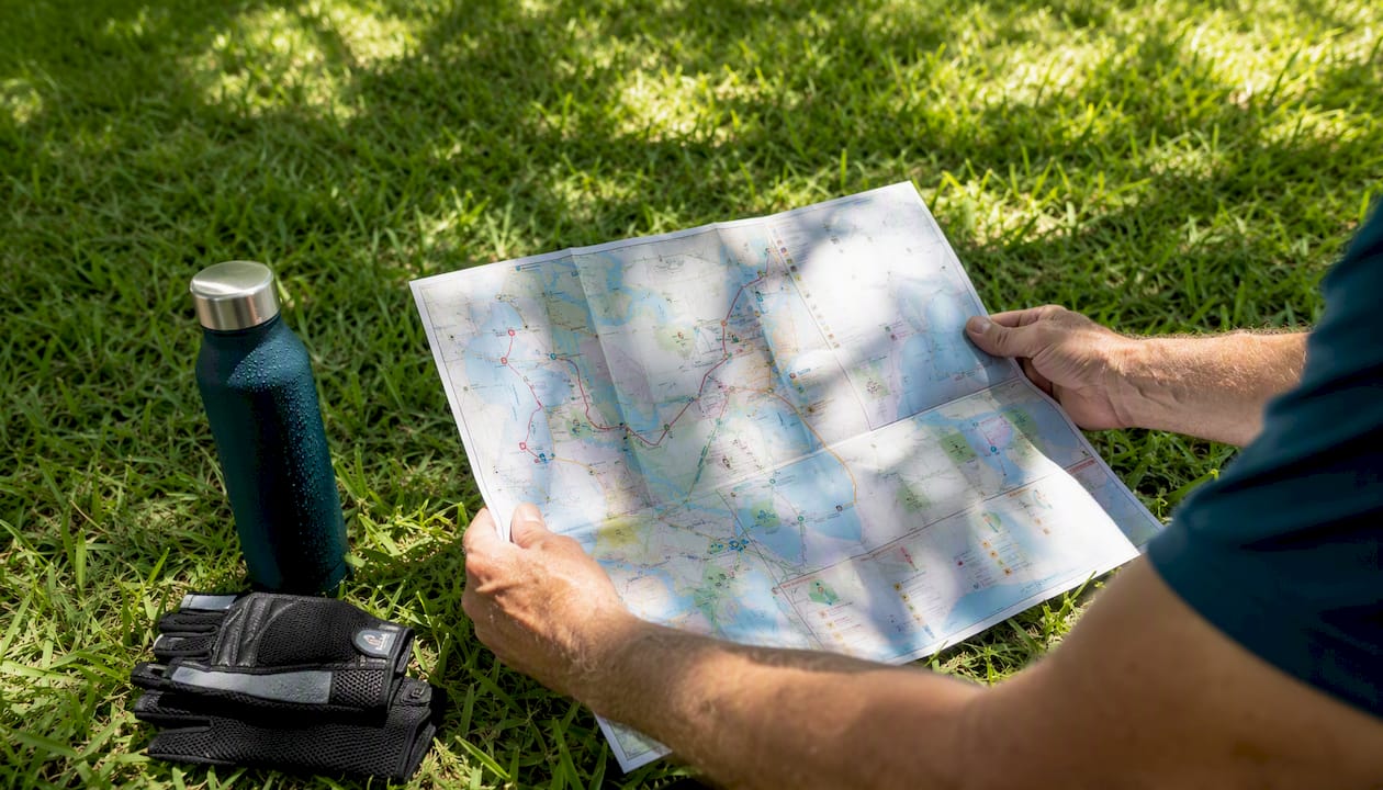
The City of Boca Raton’s “Biking in the City” brochure is the most reliable starting point. It is a free PDF download from the city’s Bicycles and Pedestrians page, and a printed version is available at City Hall and community centers. The map shows bike lane classifications, shared-use paths, and any active construction zones that might affect your route.
For GPX files and community-sourced route data, two platforms cover Boca Raton well. Bikemap hosts a community route database where riders upload GPS-tracked rides with elevation profiles and surface notes. You can browse routes by distance or difficulty, then export a GPX file directly from the route page. Load that file into RideWithGPS, Komoot, or Strava by going to the app’s “Import Route” or “Create Route” section and uploading the .gpx file. All three apps will display turn-by-turn navigation from the file. TrailLink (operated by Rails-to-Trails Conservancy) lists named trails with trailhead addresses, surface type, user reviews, and ratings. It is particularly useful for finding the exact parking coordinates for a trailhead before you drive out.
For multimodal planning, Tri-Rail’s bicycle information page covers which trains allow bikes on board, locker availability at stations, and any permit requirements. Palm Tran’s Bikes on Buses program lets you load your bike onto a Palm Beach County bus rack, which is useful for one-way rides where you want to bus back to your car. Broward County Transit runs a similar program on its routes.
The best bike routes in Boca Raton: 6 rides with distances and access points
El Rio Trail is the backbone of Boca Raton cycling. At approximately 4.8 miles of paved surface, it connects to the T-Rex Trail and gives you a shaded, low-traffic corridor that works equally well for a family afternoon or a warm-up loop before a longer effort. The Yamato Road Tri-Rail station sits close to the northern end, so you can park free at the station and ride directly onto the trail. This is the single most practical hub for combining transit with a ride.
Pro Tip: Before committing to the full El Rio loop, ride the first mile out and back from the Yamato Road trailhead. The surface condition and shade coverage tell you quickly whether the day’s heat makes the full 4.8 miles comfortable.
Beyond El Rio, here are five more routes that cover the range from easy family rides to longer training efforts.
| Route | Distance | Surface | Difficulty | Primary Access |
|---|---|---|---|---|
| El Rio Trail | ~4.8 mi | Paved | Family | Yamato Rd Tri-Rail station |
| El Rio + T-Rex Loop | ~8 mi (approx.) | Paved | Medium | Yamato Rd Tri-Rail station |
| M-Path Trail (Boca segment) | ~5 mi (approx.) | Paved | Family/Medium | Street parking along corridor |
| Kitty Roedel Bicycle Path | ~2 mi (approx.) | Paved | Family | Local street parking |
| Downtown Collector Corridor | ~6 mi (approx.) | Paved road | Medium | Palm Tran bus stops / street parking |
| Coastal A1A Segment | ~6.7 mi (approx.) | Paved road | Medium/Advanced | Beach parking lots |
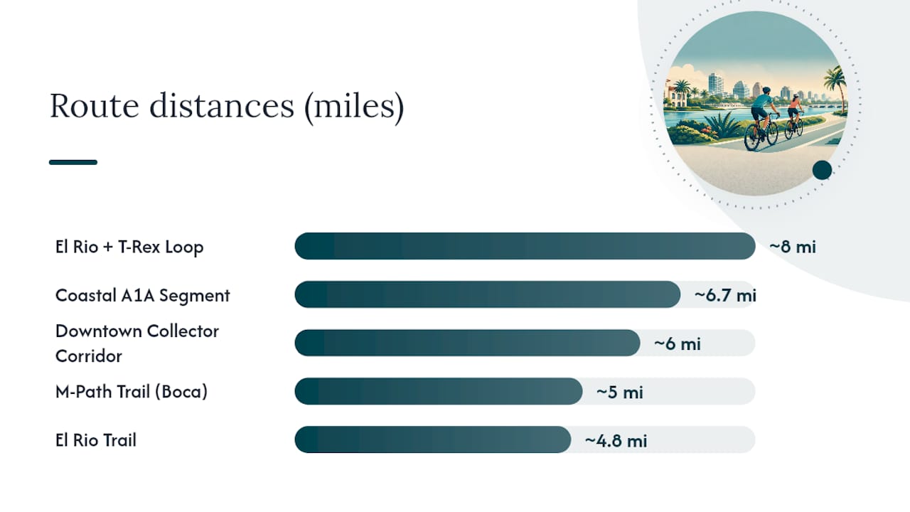
A few notes on the table: the El Rio and T-Rex combined loop distance is approximate because the connection adds mileage depending on which entry point you use. The M-Path Trail runs along the FEC rail corridor and is one of South Florida’s most continuous paved greenways. The Kitty Roedel Bicycle Path is a shorter dedicated path suited for families with young children. The A1A coastal segment offers ocean views but carries more vehicle traffic, so it fits riders comfortable with road cycling.
For each of these, search the route name on Bikemap or TrailLink to pull a GPX file with elevation data before you go.
What you need to know about Boca Raton’s bike network, transit connections, and safety rules
The city’s over 84 miles of bike lanes, shared pathways, and trails span a mix of dedicated off-road paths, painted on-street bike lanes, and shared-use sidewalk corridors. That variety is useful, but it also means the rules change depending on which surface you are on.
One critical downtown distinction: the terracotta/red lanes you see in Boca Raton’s downtown are transit-designated lanes for buses, not bike lanes. New riders frequently assume otherwise. Stay out of them on your bike and use the adjacent bike lane or road lane instead.
Under Florida Statute 316.2065, cyclists have the same rights and duties as motor vehicle drivers. That means riding with traffic, not against it, and following all traffic signals. The statute also covers lane positioning: you may ride as far right as practicable, but you are not required to hug the gutter if the lane is too narrow to share safely. Riding two abreast is permitted on paths and roads where it does not impede traffic. On sidewalks, you must yield to pedestrians. For a plain-language breakdown of where bikes may legally ride in Florida, the Florida bicycle riding rules resource from Personal Injury Lawyers of Tampa covers the key provisions clearly.
Multimodal connections worth knowing:
- Tri-Rail: bikes are allowed on board; locker programs are available at select stations including Yamato Road. Check the site for current locker permit details.
- Palm Tran: the Bikes on Buses program allows one bike per bus rack on most routes; no reservation needed, first-come basis.
- Broward County Transit: similar bike-on-bus policy for routes crossing the county line.
Safety checklist before every ride: helmet, front white light and rear red light (required by Florida law after dark), at least two water bottles for any ride over 45 minutes, sunscreen, and a basic flat kit (tire lever, patch or spare tube, mini pump).
How to time your ride, find parking, and pack for Boca Raton’s conditions
South Florida heat is the single biggest variable in ride planning. From June through September, temperatures regularly reach the low 90s°F by mid-morning, and humidity makes it feel worse. The practical window for comfortable riding is 6:00–9:00 AM or after 5:30 PM during summer months. October through April opens up the full day, with March and April offering the best combination of low humidity and mild temperatures for longer efforts.
Parking and trailheads:
- Yamato Road Tri-Rail Station is the most versatile hub. Free parking, direct trail access to El Rio and T-Rex, and a train connection if you want to extend your range north or south.
- Street parking along the M-Path corridor is generally available at cross streets; no permits required for most sections.
- Beach parking lots on A1A charge a fee during peak hours; arrive before 8:00 AM to avoid both the fee and the traffic.
Pack light but pack smart. For any ride over an hour in Boca Raton’s heat: two full water bottles (minimum), electrolyte tabs or a sports drink, SPF 50 sunscreen applied before you leave the car, a small saddle bag with a spare tube and tire lever, and a folding multi-tool. Leave valuables locked in your car’s trunk rather than visible on the seat. Where Tri-Rail lockers are available, they are a better option for storing a bag during a longer ride.
Wayfinding on the trails is generally clear. El Rio and the M-Path both have posted signage at major intersections. Downtown, follow the painted bike lane symbols on the road surface and ignore the red transit lanes entirely.
How Boca Raton’s bike policy shapes the routes you ride today and tomorrow
The city’s Transportation Element directs Boca Raton to integrate sidewalks, bikeways, greenways, and trails into the street system as a core planning priority. It includes Capital Improvement Program funding commitments for bicycle and pedestrian facilities, which is why you see new trail segments and intersection improvements appearing on a rolling basis. When the city repaves a collector road or approves a new development, bike infrastructure is part of the design requirement, not an afterthought.
City Code §23-164 makes that obligation concrete: any new development or redevelopment where planned bicycle facilities are identified in the comprehensive plan must either build those segments or pay a proportionate share into the city’s fund. On-street facilities must meet Florida Greenbook design standards. The practical result for riders is that new residential areas in Boca Raton are increasingly connected to the shared-use path network from day one.
What this means for route planning right now:
- Check the city’s Bike-Pedestrian Projects page before a ride to see if any active construction affects your planned corridor.
- New trail connections near recently developed areas may not yet appear on older printed maps; the city’s online map is updated more frequently than the brochure.
- The League of American Bicyclists’ Bicycle Friendly America program provides a national benchmark for infrastructure quality; Boca Raton’s planning documents align with those standards in their design language.
The combination of the Transportation Element’s policy mandate and the §23-164 development obligation means the network will keep growing. Routes that currently require a short on-road gap to connect two trail segments are the ones most likely to get filled in over the next few years.
What these routes actually mean for different kinds of riders
Boca Raton’s cycling network is genuinely useful, but only if you match the route to what you actually want from the ride. That sounds obvious, but most riders I see struggling out here picked a route based on distance alone and ended up either bored (a training cyclist on a 2-mile family path) or overheated and underprepared (a casual rider who committed to a 15-mile road loop in July at noon).
The El Rio Trail is the right default for almost everyone trying Boca Raton cycling for the first time. It is paved, shaded in sections, and long enough to feel like a real ride without demanding fitness or navigation skill. From there, the T-Rex connection adds mileage naturally, and the Yamato Road Tri-Rail access means you can extend the ride by train if you want to explore further without backtracking.
For training riders, the honest answer is that Boca Raton’s flat terrain and consistent pavement make it excellent for tempo work and interval sessions, but the network is not designed for long uninterrupted climbs. Use the paved greenway corridors for sustained efforts and treat the city map as a tool for building custom loops rather than following a single named route end to end.
Commuters get the most value from the transit connections. A Tri-Rail start at Yamato Road, a ride through the trail network, and a Palm Tran bus for the last mile is a genuinely practical daily commute in this city. The key is testing the full route on a weekend first, at a relaxed pace, before committing to it on a workday schedule.
Living near Boca Raton’s best trails? Cynthiagardens has you covered
If you are moving to Boca Raton and want an apartment where your bike is actually part of your daily routine, the location and amenities matter as much as the rent.
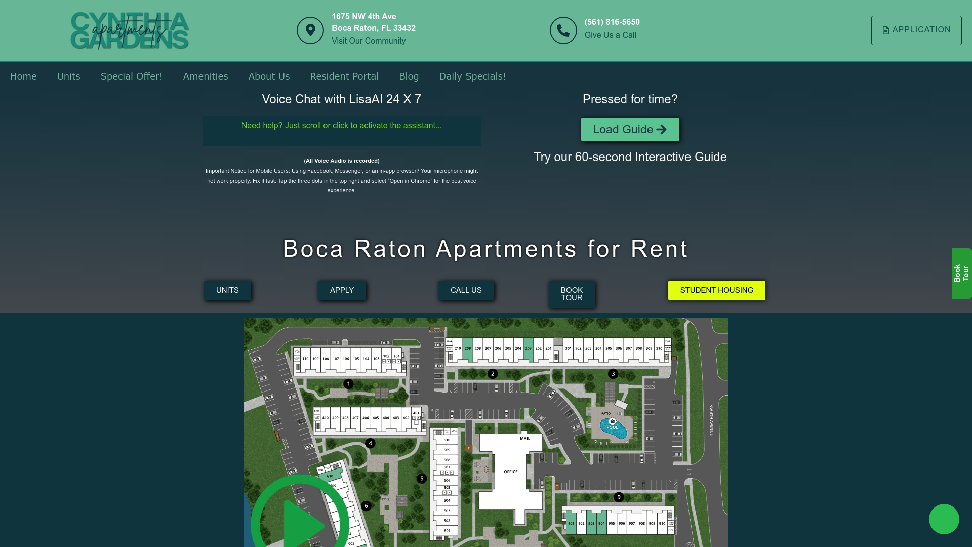
Cynthiagardens is a one-bedroom apartment community in Boca Raton built for exactly this kind of resident: young professionals, students, and pet owners who want to live close to the city’s trail network and transit connections without paying for amenities they will never use. The community offers secure bike storage so your ride is not locked to a parking lot post, pet-friendly policies for riders who bring a dog on trail days, and proximity to the Tri-Rail corridor that makes the Yamato Road station a practical starting point rather than a detour. Transparent pricing with no hidden fees means the number you see is the number you pay.
- Secure bike storage on-site
- Pet-friendly community (bring the dog on your next El Rio Trail ride)
- Close to Tri-Rail access for multimodal commutes
Browse available units and check current pricing to see what is open now. Virtual tours and AI chat support are available if you want to check the layout before visiting in person.
Primary sources and further reading
These are the sources worth bookmarking before your first ride:
- City of Boca Raton — Bicycles & Pedestrians: official “Biking in the City” map brochure (PDF download and paper pickup at City Hall); the most reliable source for current lane types and project notices.
- El Rio Trail — City of Boca Raton: official trail page with location details, parking, and contact information for the city’s primary multi-use path.
- Transportation Element — City of Boca Raton: municipal planning document covering bikeway integration policy and CIP funding commitments.
- §23-164, Boca Raton Code of Ordinances: the development regulation requiring new projects to build or fund planned bicycle facilities.
- Florida Statute 316.2065: the state bicycle regulations governing lane positioning, sidewalk riding, and cyclist rights and duties.
- Tri-Rail Bicycle Information: bike-on-train policy, locker program details, and station-specific information.
- Palm Tran Bikes on Buses: Palm Beach County bus bike-rack program for first/last-mile connections.
- Rails-to-Trails / TrailLink: trail listings with trailhead addresses, surface ratings, and user reviews for South Florida paths.
- Bike-Pedestrian Projects — City of Boca Raton: active construction and project updates that may affect downtown lane access.
Sources
- Bicycles & Pedestrians | Boca Raton, FL
- El Rio Trail | Boca Raton, FL
- Transportation Element
- 2024 Florida Statutes Title XXIII – Motor Vehicles Chapter 316 – State Uniform Traffic Control 316.2065 – Bicycle Regulations.
Recommended
- Top Activities in Boca Raton: Your Guide to Entertainment and Lifestyle – Luxury Apartments for Rent in Boca Raton | Premium Boca Raton Apartments | Aapartments Boca Raton
- Your Complete Guide to Renting in Boca Raton: Tips & Neighborhoods – Luxury Apartments for Rent in Boca Raton | Premium Boca Raton Apartments | Aapartments Boca Raton
- Top Rental Communities in Boca: A Comprehensive Guide – Luxury Apartments for Rent in Boca Raton | Premium Boca Raton Apartments | Aapartments Boca Raton
- Apartments in Boca Raton for Rent A Complete Guide – Luxury Apartments for Rent in Boca Raton | Premium Boca Raton Apartments | Aapartments Boca Raton